Plan Your Vacation
5 Hikes to Try on Your Next Trip

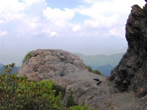

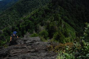
Charlies Bunion
Trail: Appalachian Trail
Driving to the Trailhead: Drive on Newfound Gap Road to Newfound Gap parking lot which is 13.2 miles from Sugarlands Visitor Center or 16 miles from Oconaluftee Visitor Center. The trailhead is to the left of the overlook, at the end of the parking lot near the restrooms.
Hiking Distance: 4.0 miles one way to Charlies Bunion
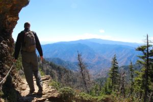

Trail: Alum Cave Trail
Driving to the Trailhead: Drive 8.6 miles on Newfound Gap Road from Sugarlands Visitor Center or 20 miles from Oconaluftee Visitor Center. There is a sign and two large parking areas marking the trailhead.
Hiking Distance: 2.5 miles one way to Alum Cave Bluffs. Alum Cave Bluffs Trail continues past Alum Cave Bluffs for a total of 5.0 miles to just below the summit of Mt. Le Conte.
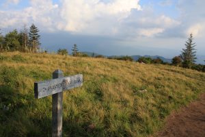
Trail: Forney Ridge Trail
Driving to the Trailhead: Drive to the Clingmans Dome parking area at the end of Clingmans Dome Road. Look for a short access trail down to the left between the bulletin board and the paved trail to the Clingmans Dome Information center and Clingmans Dome tower.
Hiking Distance: 1.8 miles one way to Andrews Bald. Forney Ridge Trail continues past Andrews Bald for a total of 5.6 miles down to Springhouse Branch Trail.
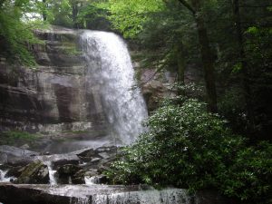

Trail: Rainbow Falls Trail
Driving to the Trailhead: Take Historic Nature Trail Drive (traffic light #8 in Gatlinburg) into the park. At mile 3.4, just after the road becomes one-way, turn right into the Rainbow Falls Parking Area.
Hiking Distance: 2.7 miles one way to Rainbow Falls. The trail continues past the falls for a total of 6.7 miles up to the summit of Mt. Le Conte.
Trailhead: Drive 6.7 miles south from Sugarlands visitor Center on Newfound Gap Road (or 22 miles north from Oconaluftee Visitor Center). Look for a large parking area on the west side of the road between the lower tunnel and “the loop”.
Distance: 4 miles roundtrip
Trail Conditions: Elevation change of 1,400 feet, this is a steep, newly-renovated trail with a rocky outcrop at the summit of the mountain.